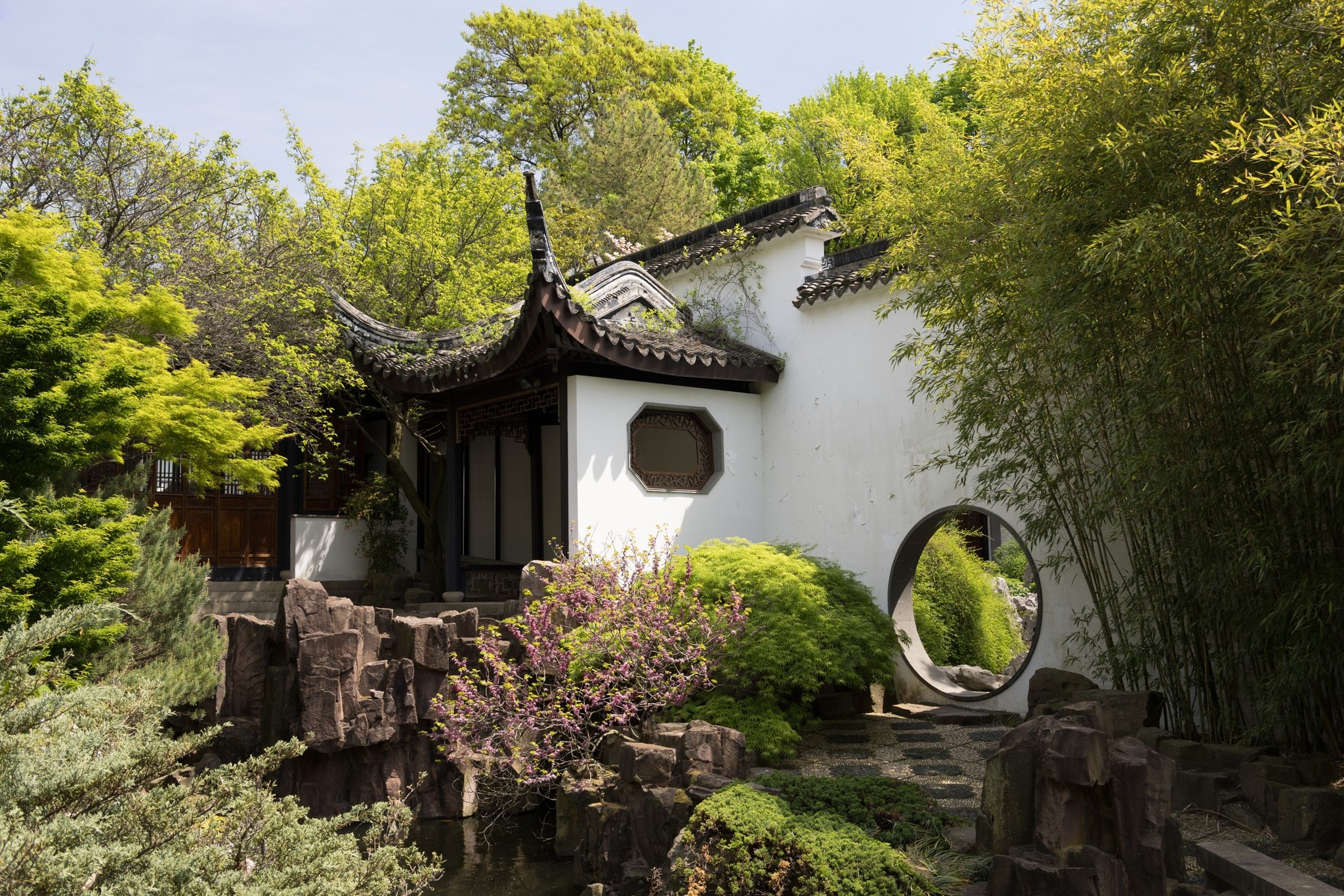
New York Chinese Scholar’s Garden at Snug Harbor on Staten Island, photographed May 1, 2025.

Outdoors

Fishing near Staten Island

Lakes, rivers and recreation areas near Staten Island where fishing is allowed, closest first.

18places to fish
5 mito the closest
5within 30 miles

Good to know: Anyone 16 or older generally needs a state fishing license; seasons, limits and special rules vary by water. New York license information ↗

Closest picks

1

Camp Gateway - Staten Island

5 mi east · National Park Service

This campground boasts a spectacular view of the Verrazzano-Narrows Bridge, the longest vehicle suspension span in the United States. When it opened in 1964, it was the longest span in the world for 17 years.

2

National Parks of New York Harbor

8 mi northeast · National Park Service

These 12 sites preserve more than 400 years of American history! We invite you to explore the past and investigate its relevance in our lives today.

3

Camp Gateway - Sandy Hook

12 mi southeast · National Park Service

Welcome to Gateway National Recreation Area, Sandy Hook Unit! There are a variety of cultural and recreational opportunities available at the park including history tours, living history demonstrations, hiking, birding, kayaking, camping,…

Map of all 18 places

Map of 18 places loads as you scroll.

Within 30 miles (5)

5 mi east · National Park Service · Campground

Camp Gateway - Staten Island

This campground boasts a spectacular view of the Verrazzano-Narrows Bridge, the longest vehicle suspension span in the United States. When it opened in 1964, it was the longest span in the world for 17 years.

  • Biking
  • Birding
  • Boating
  • Camping
  • Evening Programs
  • Fishing
  • Guided Interpretive Walks
  • Hiking

8 mi northeast · National Park Service

National Parks of New York Harbor

These 12 sites preserve more than 400 years of American history! We invite you to explore the past and investigate its relevance in our lives today.

  • Biking
  • Boating
  • Camping
  • Fishing
  • Hiking
  • History
  • Paddling
  • Picnicking

12 mi southeast · National Park Service · Campground

Camp Gateway - Sandy Hook

Welcome to Gateway National Recreation Area, Sandy Hook Unit! There are a variety of cultural and recreational opportunities available at the park including history tours, living history demonstrations, hiking, birding, kayaking, camping,…

  • Biking
  • Birding
  • Boating
  • Camping
  • Canoeing
  • Cultural Activities
  • Evening Programs
  • Fishing

12 mi east · National Park Service

Gateway National Recreation Area

Spanning 27,000 acres from Sandy Hook in New Jersey to Breezy Point in New York City, the park is both the gateway from the ocean into New York Harbor, and the gateway to the National Park Service for millions of visitors every year.

  • Biking
  • Boating
  • Camping
  • Fishing
  • Paddling
  • Swimming

14 mi east · National Park Service · Campground

Camp Gateway- Brooklyn Ny

There's no other campground in the world where a family can sleep under the stars, tour the Statue of Liberty, watch a Broadway musical and kayak in one of the world's premier bird migration sanctuaries-all in one trip.

  • Archery
  • Biking
  • Camping
  • Fishing
  • Hiking
  • Horseback riding
  • Ranger programs
  • Star Gazing

30 to 75 miles (11)

41 mi northeast · Fish and Wildlife Service

Congressman Lester Wolff Oyster Bay National Wildlife Refuge

The Congressman Lester Wolff Oyster Bay National Wildlife Refuge was donated to the Service by the Town of Oyster Bay in 1968 as a habitat for migratory birds, particularly wintering waterfowl.

  • Birding
  • Boating
  • Educational Programs
  • Fishing
  • Non-Motorized Boating
  • Photography
  • Ranger programs
  • Wildlife viewing

45 mi northeast · Fish and Wildlife Service

Target Rock National Wildlife Refuge

Target Rock National Wildlife Refuge was acquired in 1967 as a donation from the Eberstadt family, who maintained the land as a garden estate.

  • Beach
  • Birding
  • Fishing
  • Hiking
  • Ranger programs
  • Wildlife viewing

46 mi west · National Park Service

Lower Delaware National Wild and Scenic River

The Delaware River, the largest free-flowing river in the eastern United States, runs past forests, farmlands and villages. It also links some of the most densely populated regions in America.

  • Boating
  • Camping
  • Fishing
  • Hiking
  • Paddling
  • Picnicking

48 mi northwest · Fish and Wildlife Service

Wallkill River National Wildlife Refuge

Wallkill River National Wildlife Refuge manages over 6,000 acres in Sussex County, New Jersey and Orange County, New York. We strive to manage quality habitat for wildlife while providing outdoor recreation for the public.

  • Boating
  • Educational Programs
  • Fishing
  • Hunting
  • Photography
  • Wildlife viewing

50 mi east · Fish and Wildlife Service

Seatuck National Wildlife Refuge

The refuge, located in Islip on the south shore of Long Island, consists of 209 acres bordering the Great South Bay, and is separated from the Atlantic Ocean by Fire Island.

  • Fishing
  • Hunting

55 mi northwest · National Park Service · Campground

Alosa Campsites

The Alosa Campsites are boat-in only sites located on the west (Pennsylvanian) shore of the Delaware River near Bushkill, Pennsylvania. The side of the river with the campsites will be on your right while traveling downstream.

  • Boating
  • Camping
  • Canoeing
  • Fishing
  • Hiking
  • Swimming

56 mi northwest · National Park Service

Delaware Water Gap National Recreation Area

Situated within the most densely populated region of the United States, Delaware Water Gap National Recreation Area provides a unique opportunity to experience tranquil landscapes, rich human history, and striking scenery along 40 miles of…

  • Biking
  • Boating
  • Climbing
  • Fishing
  • Hiking
  • History
  • Horseback riding
  • Hunting

61 mi east · National Park Service

Fire Island National Seashore

Immerse yourself in an enchanting collage of coastal life and history. Rhythmic waves, high dunes, ancient maritime forests, historic landmarks and glimpses of wildlife, Fire Island has been a special place for diverse plants, animals and…

  • Boating
  • Camping
  • Fishing
  • Hiking
  • History
  • Hunting
  • Swimming
  • Wildlife viewing

68 mi south · National Oceanic and Atmospheric Administration

Jacques Cousteau National Estuarine Research Reserve

The Jacques Cousteau National Estuarine Research Reserve, at Mullica River and Great Bay, is the only reserve in the national system to be named after an individual.

  • Biking
  • Fishing
  • Hiking
  • Paddling
  • Photography
  • Picnicking
  • Swimming

68 mi east · Fish and Wildlife Service

Wertheim National Wildlife Refuge

Established in 1947, Wertheim National Wildlife Refuge protects 2,550 acres on the south shore of Long Island.

  • Birding
  • Boating
  • Cross Country Skiing
  • Educational Programs
  • Fishing
  • Hiking
  • History
  • Hunting

73 mi north · Fish and Wildlife Service

Shawangunk Grasslands National Wildlife Refuge

Shawangunk Grasslands National Wildlife Refuge, which protects 597 acres in Ulster County, NY, was established in July 1999 to support grassland-dependent migratory birds and wintering raptors.

  • Fishing
  • Hunting
  • Photography
  • Wildlife viewing

75 miles and farther (2)

86 mi northeast · US Army Corps of Engineers · Campground

Hop Brook Lake Recreation Area

Hop Brook Lake Recreation Area is located within the towns of Middlebury, Naugatuck and Waterbury, Connecticut. Its 536 acres provide excellent recreation opportunities and a chance to escape from the growing suburbia surrounding the park.

  • Biking
  • Boating
  • Camping
  • Canoeing
  • Cross Country Skiing
  • Fishing
  • Hiking
  • Kayaking

94 mi northeast · US Army Corps of Engineers · Campground

Northfield Brook Lake Group Shelters

Northfield Brook Lake Group Shelters are located along a small scenic lake in the Naugatuck Valley of west-central Connecticut.

  • Biking
  • Birding
  • Camping
  • Canoeing
  • Fishing
  • Hiking
  • History
  • Kayaking

Distances are straight-line miles from downtown Staten Island. Listings come from Recreation.gov’s federal recreation database; check each official page for hours, fees, fire restrictions and closures before you go.

Get outside around Staten Island

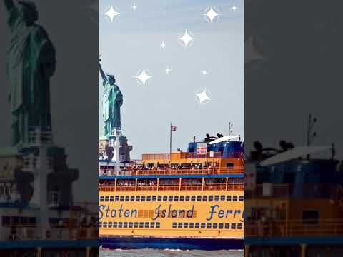
2 Places to visit in STATEN ISLAND, NY video thumbnail

THINGS TO DO · YOUTUBE SHORT

2 Places to visit in STATEN ISLAND, NY

An activity Short shared by Monique.

Watch on YouTube ↗
A lovely spot on Staten Island: Snug Harbor video thumbnail

THINGS TO DO · YOUTUBE SHORT

A lovely spot on Staten Island: Snug Harbor

An activity Short shared by Hava Media.

Watch on YouTube ↗

Around Staten Island

Empire Outlets SI td, Staten Island
Empire Outlets SI td (2022-07-04) 019Tdorante10 · CC BY-SA 4.0
FDR Boarwalk & Beach, Staten Island
FDR Boarwalk & Beach (10403381436)Shannon from Huntsville, USA · CC BY-SA 2.0
Beach in Wolfes Pond Park on Staaten Island looking northeast, Staten Island
Beach in Wolfes Pond ParkWusel007 · CC BY-SA 3.0

More outdoors near Staten Island

Questions

Where is the closest place for fishing near Staten Island?

Camp Gateway - Staten Island (National Park Service), about 5 miles east of Staten Island as the crow flies. Next are National Parks of New York Harbor (8 mi) and Camp Gateway - Sandy Hook (12 mi).

Do I need a fishing license near Staten Island?

Yes, anglers 16 and older generally need a New York fishing license from the state wildlife agency. Rules, seasons and limits vary by water.

Who manages these places?

Federal agencies including National Park Service, Fish and Wildlife Service, US Army Corps of Engineers. Each listing links to its official page for hours, fees, closures and current conditions.

Staten Island AI

Your Staten Island local guide
Hey there!

I'm Staten Island AI. Ask about local food, shops, museums or a neighborhood day.

AI recommendations may be inaccurate. Verify hours and prices. Questions are processed by Cloudflare. Privacy